Boxing Day is a strange day isn’t it. The excitement of Christmas Day has passed, you spend most of the day picking at cold leftovers, and lethargy begins to kick in.
For us, Boxing Day was strange because we were leaving the cottage so we knew we had to pack everything away and clean it up (this ain’t a hotel… You have to leave it as you found it) but as per usual, we had no plan of what to do after that. Do we just head home and relax? Do we hang about at the cottage and leave late? Do we pack up early and head out for an adventure somewhere? With still no idea we seemed to naturally begin packing our things away and before we realised, we were putting antifreeze down sinks, sweeping floors and putting boards back up at windows.
There’s a heavy reluctance as we leave. It seems wrong for this place to sit empty. During the summer it’s alive with a constant bustle of schoolkids on outdoor expeditions and visitors enjoying it as a summer getaway, but during the winter it sits lonely and empty, gazing across the valley waiting for the next people to come and appreciate its sanctuary. But for now it rests. We trundle back down the hill to the valley floor, incredibly grateful that we’re among a limited group of people who get to enjoy and appreciate the haven in the hills.
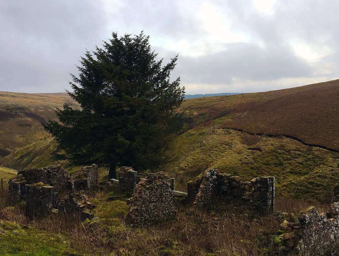
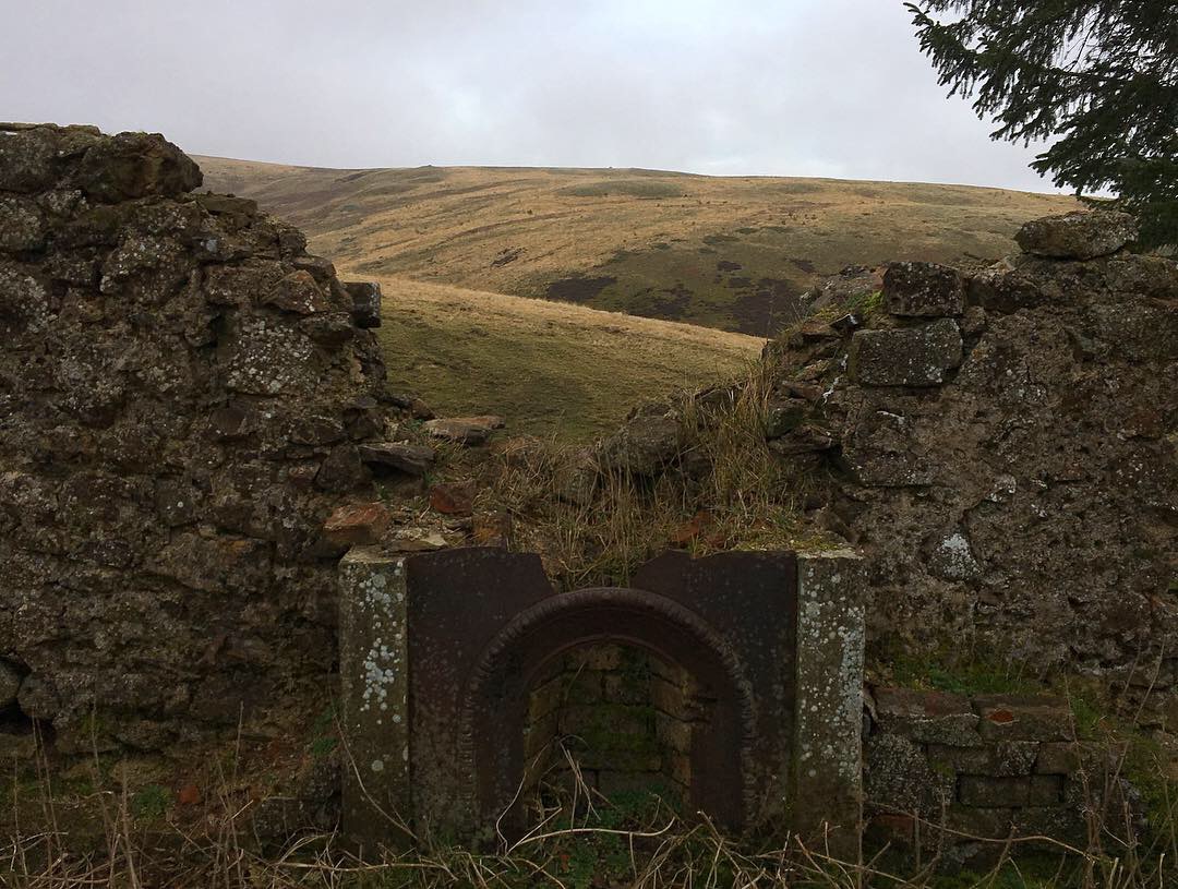
Once on the valley floor we notice that the Forestry gate leading up the Yoke Burn is open, and this leads right past the remains of Memmerkirk. We decide, with reckless abandon, to drive up the road to find it. Precious little remains of this building and if you didn’t know it was there you would miss it without doubt (turns out I rode right past here in the summer and didn’t realise this was it), but we follow along the road making constant reference to our map and our new Coquet Valley bible until we find the remains.
The building was thought to be a medieval chapel built for the use of the monks’ servants who were herding their flocks in surrounding pastures, but excavations in 1962 by a local archaeologist showed no evidence of it being a religious building. She suggested, instead, that it had been of domestic use and had been re purposed in the seventeenth century with stories of a chapel perhaps arising from dissenting Presbyterians using it a a private place of worship; stories evidenced in the will of James Burne of Kidlandlee when money was left to ‘the Congregation of Protestant Dissenters’ of Harbottle who were known to meet in a private dwelling.
Despite there being nothing but a mound of earth to look at (yes, that is indeed it in the photo above) I grin like a Cheshire cat standing at this spot. How vastly different must the valley have looked at the time of this building’s use? The Forestry Commission only started working the land in the 1950’s so before that it would’ve been open moorland like its neighbouring hills, but the rubble of this building has stood through all of it. The Forestry fireroad was built right alongside the squat remains that are being gradually absorbed back into the landscape with decades of overgrowth.
We make our way back through the valley, out to the village of Alwinton and turn right heading through a road sign suggesting that the road is a dead end. It’s not really a dead end. If the red flags of the military land on the opposite side of the road are flying it is, but if not then the road goes all the way through to Otterburn.
We drive through to Barrowburn and stop on the grass verge right opposite the Windyhaugh farm to hunt in the river for the remains of the wheel pit belonging to an old wool mill that sat on the banks. Coquetdale Community Archeology excavated the area in 2010 and found notable remains of the wheel pit and a washing area, as well as a wooden floor further upstream. The river is probably a little too high to see much of it, and we possibly look like idiots standing on the edge of the river pointing at blocks, but nonetheless we find enough of the remains to make it a worthwhile stop off.
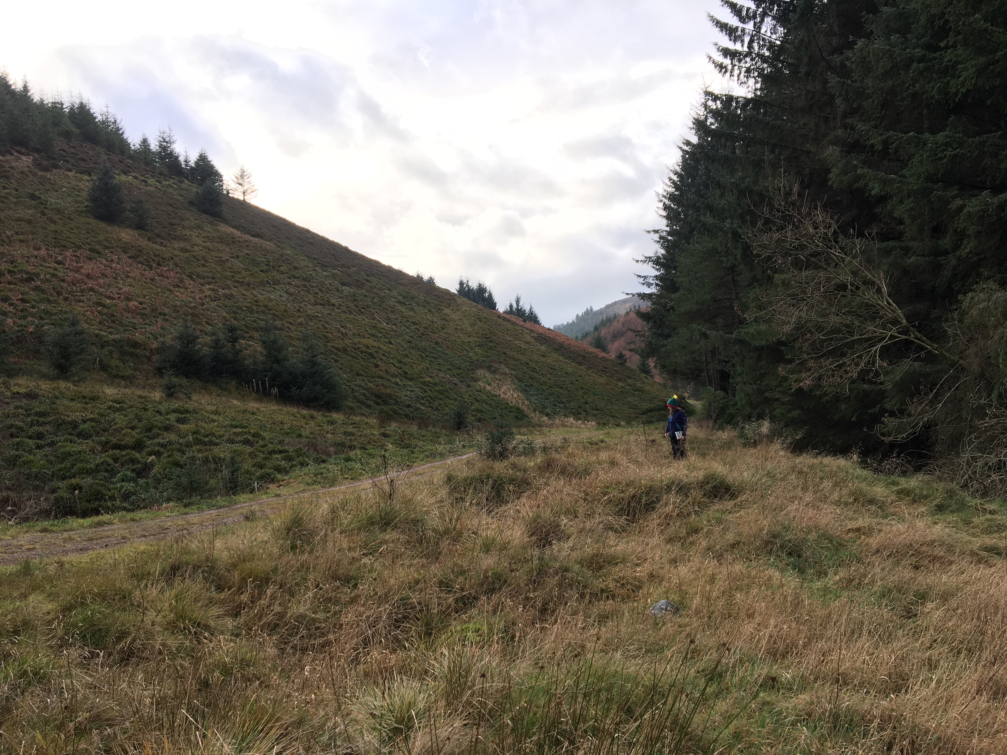
We still haven’t actually decided what to do with our Boxing Day. We’re just moseying along the valley mooching at bits and bobs, so when Hogs sees a photo in our Coquet bible of the ruins of Yearning Hall we know that we’ve found our adventure. It’s around 2 miles off the main road from Blinburn and with Hogs still nursing a cold it’s an ideal short walk that won’t be too strenuous.
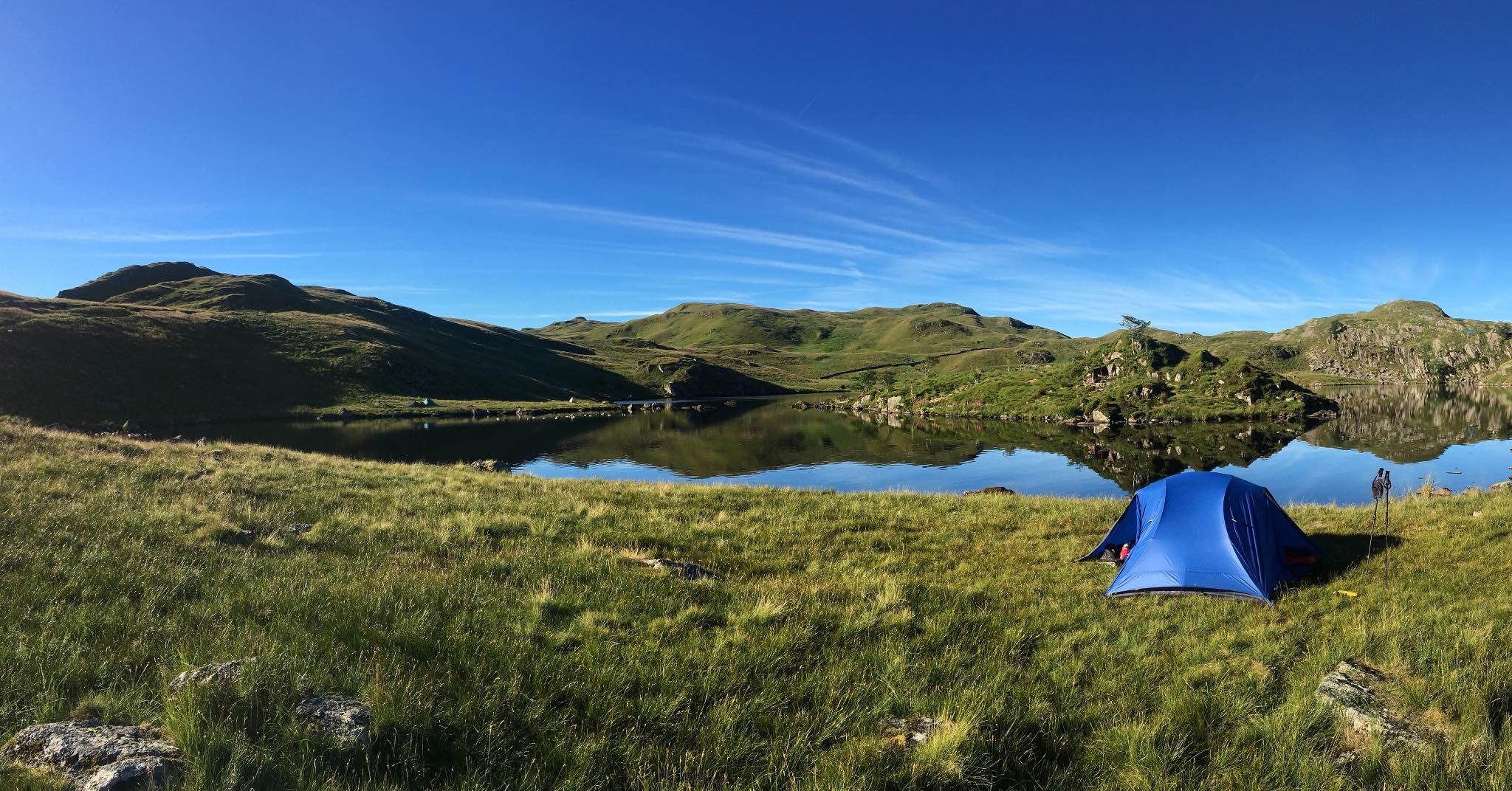
We pitch up at the car park just beyond the Blinburn farm, pack our trusty essentials and head off up a familiar footpath that leads up the burn. We’ve walked up here before. In January 2017 four of us walked up here one evening to wild camp at the Yearning Saddle mountain refuge hut on Lamb Hill. We follow the burn upstream for about half an hour or so until we reach a junction.
We get out the map and check it against the route from the book.
Oh my god.
We’ve come up the wrong footpath.
We’re almost 2 miles off course.
We just sort of stand there, staring at each other in disbelief. We were supposed to start from Blindburn FARM, not Blindburn car park. Ugh!
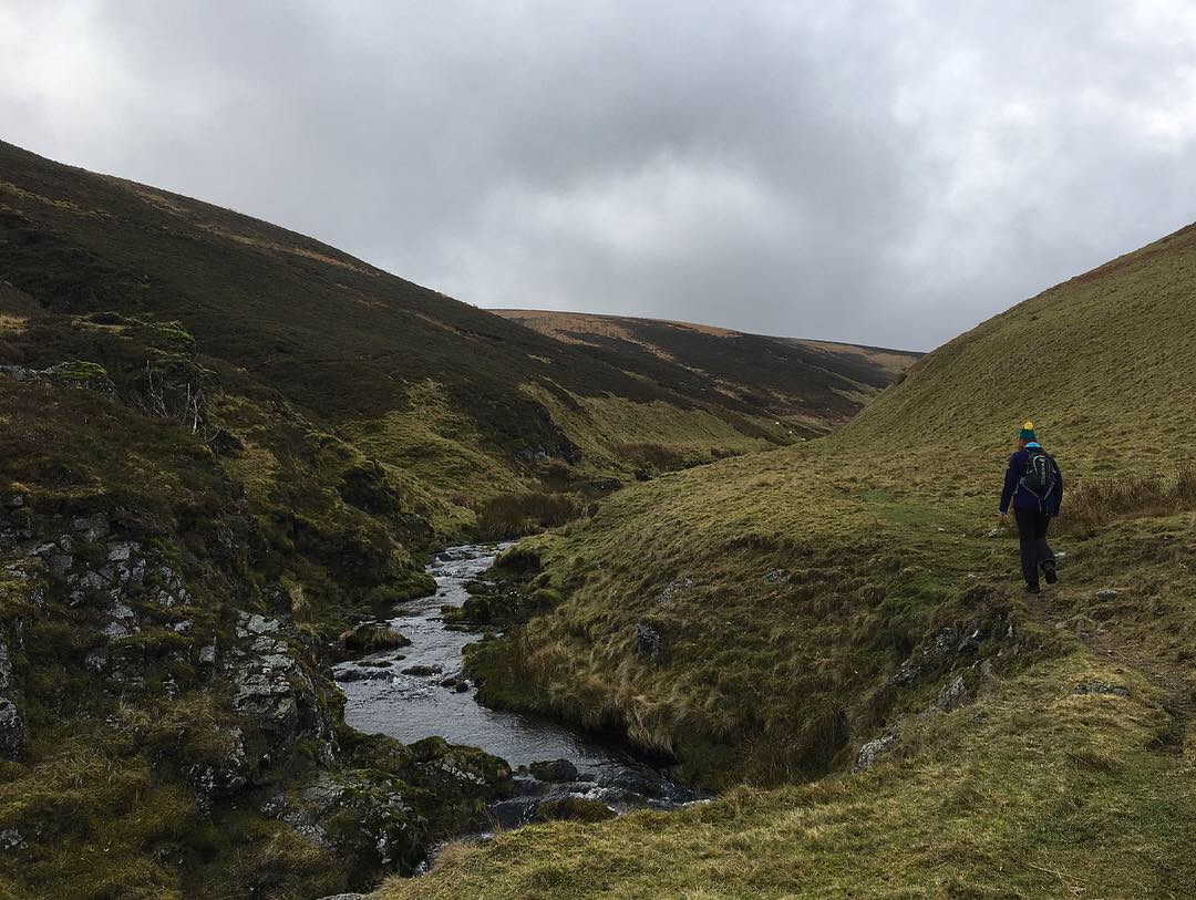
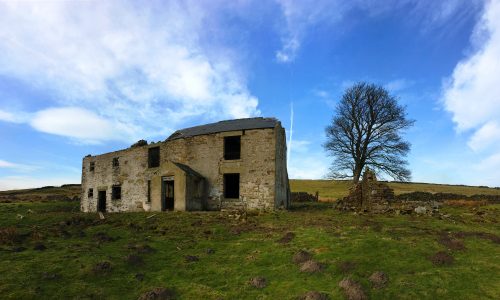
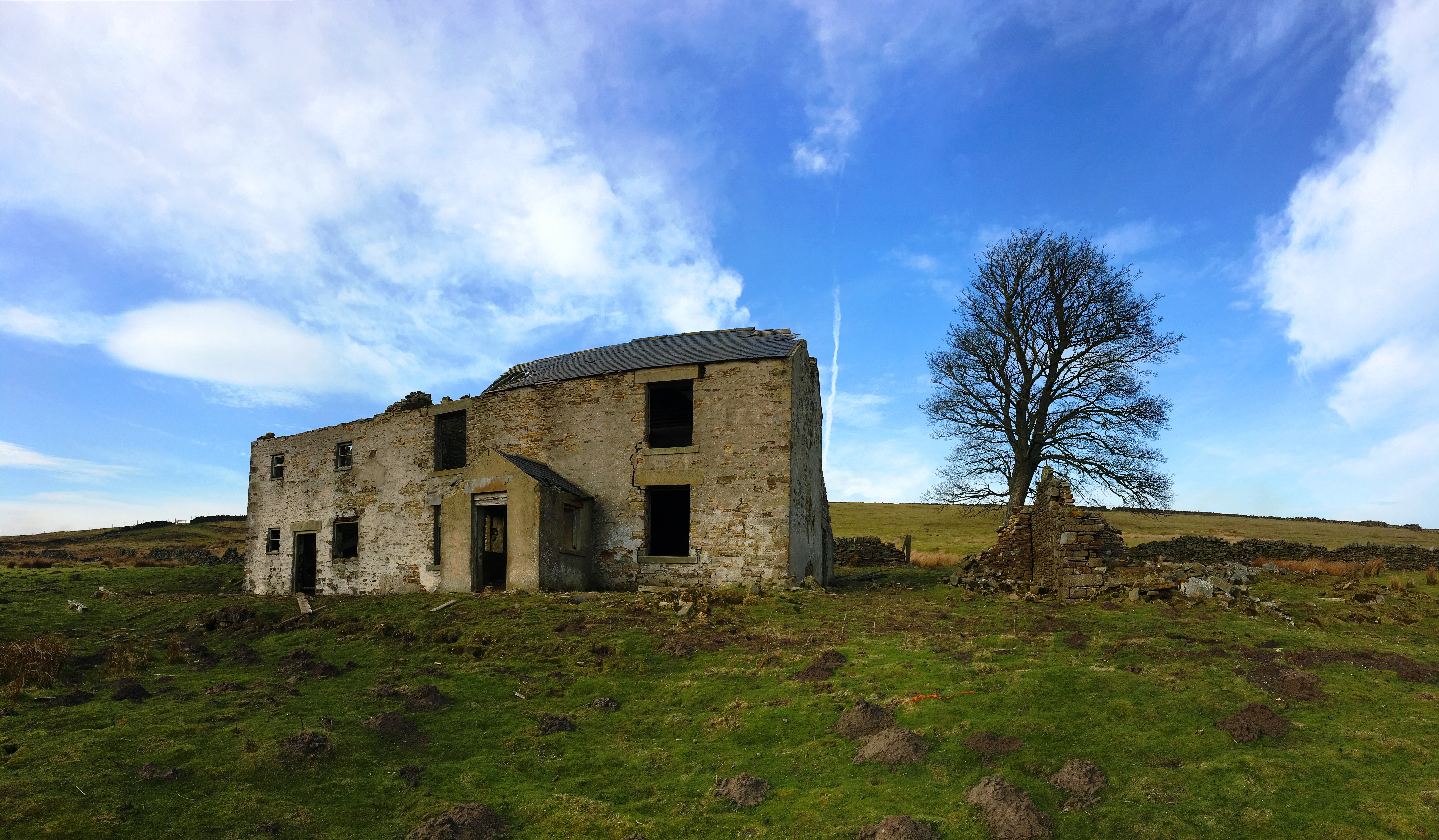
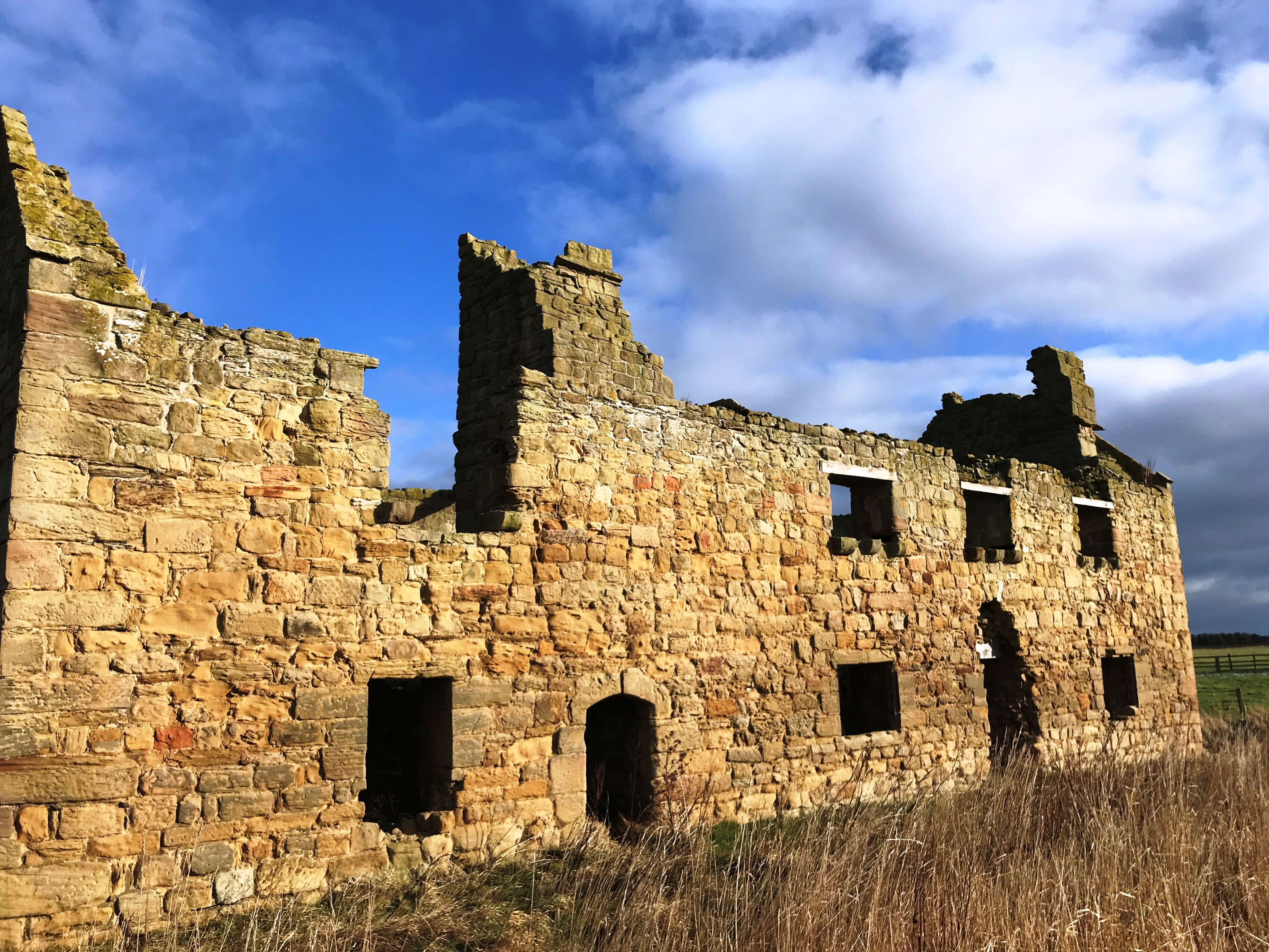
Given that we really don’t like backtracking, and trying to save face, we quickly suss out a revised route and continue on, taking a shortcut up a broad farmers track that leads across to the bridleway that runs alongside Yearning Law. Once up on the summit we keep the height, scanning around for the remains of the Hall. We quickly spot them down the slope on the other side of the burn and forge our way down the grassy hillside looking for a place to cross. On the way down the remains come clearer into view but even so, this place is so small and unassuming. Even if it were still an intact and inhabited farm house it doesn’t take a commanding place in the hills. In fact, by the time we reach it and begin looking around its sparse remains we’re quite taken aback at how remote and easily missed it actually is.
The now derelict farmhouse was lived in until the 1940’s, and we just can’t imagine how difficult it must’ve been living here in such a relatively modern era. There’s no nipping out to the Co-Op for milk or bread; it’s almost 20 miles in any direction to the nearest town and the nearest road is 2 miles away so getting any provisions up here is an endeavour. We can only imagine that the family were quite self-sufficient but isolated.
Little remains of it above window sill level, but there’s enough to allow you to picture life here on the edge of a small burn in a quiet corner of the Cheviots. The farm was first recorded in 1777 and survived for almost 200 years, so despite our reservations about the remoteness it obviously worked.
The sun is beginning its final descent, so we leave Yearning Hall disappearing into the shadows for another day and make our way down the Blind Burn. On this final leg back to the car we pass a few old settlements that no doubt pre-date Yearning Hall. There are no historic records for them so all we can do is pass by their nameless ghosts and acknowledge their remains. By the time we get back to the car we’ve walked far further than we had planned to, but we’ve more than satiated our appetite for a Boxing Day adventure. We walked up some paths we’ve never been before, and found ruins we’ve not visited. All in all, I think that makes it a pretty darned excellent day.